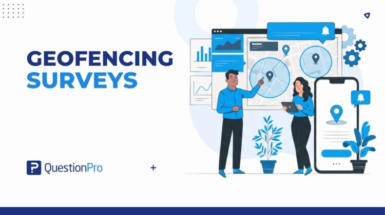
Geofencing surveys send a push notification and a short questionnaire the moment someone enters or leaves a specific physical location. A retail chain, a university, or a public health team can use this to collect feedback while an experience is still fresh.
Most smartphones already share location data with apps like Yelp or Google Maps, which is why a notification about a nearby restaurant feels routine. Geofencing surveys work on the same principle, except the alert leads to a research question instead of a coupon.
This guide breaks down what geofencing surveys are, how they work, and where they fit into a wider location-based market research strategy. It also covers real examples, common mistakes, and how to set one up.
What is a geofencing survey?
A geofencing survey is a location-based survey that appears automatically when a mobile device crosses a virtual boundary drawn around a place, such as a store entrance or an event venue. That virtual boundary is called a geofence.
Geofencing surveys sit inside the wider field of location-based market research, which also includes GPS exit surveys and mobile ethnography studies. What sets a geofencing survey apart is the trigger: the survey only appears because the device physically entered or left a defined space, not because a researcher guessed the timing.
Respondents must already belong to an opt-in panel or have a survey-enabled app installed on their phone. An opt-in panel is a group of people who agreed in advance to receive research invitations, so geofencing never tracks random strangers who happen to walk by.
How do geofencing surveys work?
A geofencing survey runs in four steps, from drawing the boundary to collecting a response.
- Set up the geofence.
A researcher draws a virtual boundary around the target location using GPS coordinates or a mapped address radius.
- Load participants.
Opted-in panel members or app users are enrolled in the study so the system knows who to notify.
- Trigger the notification.
When a device crosses the boundary, the app or an SMS system sends a push notification inviting the person to respond, the same way many mobile surveys reach people outside a desktop setting.
- Collect and validate the response.
The survey opens instantly, and the location data can confirm the person was actually on-site.
Types of geofences
Geofences are not all the same shape, and the type used affects how precise the trigger is.
- Circle geofence: a radius drawn around a single point, useful for a store entrance or a trade show booth.
- Polygon geofence: an outline that matches an irregular shape, such as a stadium or a campus.
- Isochrone geofence: a boundary based on travel time rather than straight-line distance, useful for drive-time studies.
Geofencing surveys vs. intercept surveys and geotracking
Geofencing sounds similar to a few other research and marketing terms, and mixing them up leads to the wrong method for the job.
| Method | How it works | Best for |
|---|---|---|
| Geofencing survey | Notification fires only when a device crosses a set boundary | On-site feedback tied to a specific visit |
| Geotracking | Continuously records a device’s location at set intervals | Long-term movement patterns, not a single visit |
| Intercept survey | A live interviewer approaches people in person, usually with a tablet | Detailed, moderated feedback without app dependency |
The distinction between geofencing and geotracking matters for privacy. A peer-reviewed geofencing methodology study notes that geotracking continuously records a device’s absolute location at regular intervals, which raises more privacy questions than a boundary-only trigger. Intercept surveys, meanwhile, need a physical interviewer on-site and do not rely on a smartphone at all.
Real-world examples of geofencing surveys
Geofencing surveys work across very different industries, from retail to public health. A few examples show the range.
- Ad recall testing.
A brand runs an in-store ad in half its locations and skips the other half. Every location is loaded into the system, but only shoppers who enter a “test” store receive a survey about the ad, letting the brand isolate its actual effect on recall.
- Retail and restaurant experience.
A regional chain triggers a short customer satisfaction survey the moment a shopper’s phone leaves the parking lot, capturing service and cleanliness feedback while the visit is still top of mind.
- Event and conference feedback.
Attendees crossing into a venue receive a short survey about session quality or booth engagement, replacing a paper form at the exit.
- Academic and public health research.
Government, university, and nonprofit teams have used geofenced surveys to study behaviors such as smoking habits, transportation choices, and illness prevention across specific neighborhoods or facilities.
Benefits of geofencing surveys and when to use them
Geofencing earns its place in a research toolkit because it solves problems a traditional online survey cannot.
- In-the-moment accuracy: Feedback arrives while the experience is still fresh, reducing recall bias.
- Lower cost than staffed intercepts: No interviewer needs to stand at every location in person.
- Built-in validation: Location data confirms the respondent was actually on-site, adding confidence to the response.
- Scalable across locations: One setup can cover dozens of stores, campuses, or event sites at once.
- Passive targeting: Researchers do not need to ask “Were you at Location X?” inside the survey, since the geofence already confirms it.
Geofencing tends to make the most sense when a business needs feedback tied to a specific visit across many sites at once. A single-location study, or one where respondents are not smartphone users, is usually better served by a traditional intercept.
Common mistakes and limitations of geofencing surveys
Geofencing is not foolproof, and a few recurring mistakes cause weak data or low response rates.
| Mistake or limitation | Why it matters |
|---|---|
| Relying on GPS alone indoors | Indoor GPS accuracy can fall off sharply compared to outdoor readings, causing missed or false triggers |
| Skipping opt-in consent | Surveys can only reach people who already agreed to location tracking, so consent gaps shrink the usable sample |
| Ignoring dwell time | Very brief visits, such as passing a bus stop, are less likely to register a valid trigger |
| Testing only one location | A single site rarely produces a large enough sample to generalize results |
| Draining battery with active tracking | Continuous foreground GPS use increases battery drain and can lead users to disable location sharing |
How to measure the success of a geofencing survey program
Whether a geofencing program is working comes down to a handful of location-specific metrics that a standard survey report will not show on its own.
- Trigger rate: The percentage of people who entered the geofence and actually received the notification.
- Response rate by location: Completion rates broken out per site reveal which locations need a wider radius or a redesigned prompt.
- Dwell time correlation: Comparing time spent on-site against survey answers shows whether longer visits change sentiment.
- Notification-to-completion time: How quickly people respond after the alert, which flags friction in the survey length or design.
- Opt-out and permission drop-off: Tracking how many participants disable location sharing over time protects long-term sample size.
Setting up geofencing surveys with QuestionPro Communities
Launching a geofencing survey does not require building location technology from scratch. The QuestionPro Communities app lets research teams draw a geofence, load locations, and push a branded survey through one mobile app, instead of stitching together custom infrastructure or a separate survey software tool.
- Define the study locations and draw a geofence, or several, around each one.
- Load the community or opt-in research panel members who should receive the survey on entry or exit.
- Build the survey and set the trigger to fire on entry, exit, or both.
- Launch, monitor trigger and completion rates in real time, and adjust the radius or wording as data comes in.
A dedicated onboarding team typically supports the first launch, so setup is usually measured in days rather than weeks.
Location context turns feedback into decisions
A survey answered the moment someone leaves a store carries more weight than one filled out days later from memory. Geofencing does not replace every research method, but it adds a layer of context that a standard online panel cannot match on its own.
For teams building a broader location-based research program, geofencing surveys work best as one tool inside a wider market research software toolkit, alongside communities, panels, and mapped customer journey touchpoints. Paired with clear consent practices and a realistic radius, it gives a clearer read on what happened, where, and why.
Frequently Asked Questions (FAQs)
Geofencing triggers an action, like a survey, only when a device crosses a set boundary. Geotargeting is broader marketing based on a general area, such as a city or zip code, without needing entry or exit detection at all.
Yes, but accuracy drops. GPS alone is unreliable inside buildings, so many programs pair it with Wi-Fi or Bluetooth signals to detect entry and exit more precisely near store entrances or building floors.
Cost depends on the number of locations, the panel size, and whether a team builds custom geofences or uses an existing platform. Most programs are priced per location or per completed response rather than a flat fee.
Yes, when consent is collected upfront. Compliant programs only notify opted-in panel members, disclose how location data gets used, and avoid storing precise location history beyond what the study actually needs.
Not always. Intercept surveys still work better for populations without smartphones, reliable data plans, or app access, while geofencing scales more easily across many locations and removes interviewer bias from the data.